Have you ever thought about how just a few countries cover more than half of our planet? Imagine wandering through icy plains that make your cheeks tingle, meandering in lush forests filled with the sound of nature, and exploring busy cities buzzing with life. In this guide, we take a close look at the biggest countries and share the unique adventures and hidden stories they offer. We’re not just talking about numbers; we’re uncovering the secrets behind landscapes that have shaped cultures and stories over time. So, ready to pack your curiosity and hit the road with me?
Rankings of the Largest Countries by Land Area
Have you ever thought about just how massive some countries are? These rankings show more than just numbers, they hint at the incredible variety of landscapes and cultures out there. Imagine standing on the endless, wintry plains of Russia, where each step might reveal a secret corner of nature waiting to be discovered. It’s like opening a travel journal full of adventure and history.
| Rank | Country | Area (km²) | Area (sq mi) |
|---|---|---|---|
| 1 | Russia | 17,098,242 | 6,602,000 |
| 2 | Canada | 9,984,670 | 3,855,103 |
| 3 | China | 9,706,961 | 3,747,879 |
| 4 | United States | 9,372,610 | 3,618,777 |
| 5 | Brazil | 8,515,767 | 3,287,956 |
| 6 | Australia | 7,692,024 | 2,969,907 |
| 7 | India | 3,287,590 | 1,269,219 |
| 8 | Argentina | 2,780,400 | 1,073,500 |
| 9 | Kazakhstan | 2,724,900 | 1,052,088 |
| 10 | Algeria | 2,381,741 | 919,595 |
These stats are more than just numbers on a page. They reveal the hidden stories of vast terrains, abundant natural resources, and cultural riches that shape our world. When you see a country’s rank, think about its rugged mountains, sprawling forests, or bustling cities, the land helps tell its unique story. Isn’t it amazing how geography can shape the history and character of a nation?
Geographic Features of the World’s Largest Countries
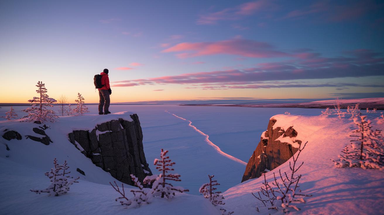
Have you ever imagined stepping into Russia's endless wilderness where icy Arctic scenes blend into lush forests and open fields near the Ural Mountains? It’s like nature is showing off its best colors, with explorers once marveling at the endless ice and the sudden bursts of vibrant forest hues before heading off on an Arctic adventure.
Then there’s Canada. Picture yourself wandering through the rugged Rocky Mountains, crossing wide open prairies, and exploring a quiet Arctic land dotted with over two million sparkling lakes. You can almost feel the cool mountain air, hear the soft rustling of forests, and sense the calm of a hidden lake.
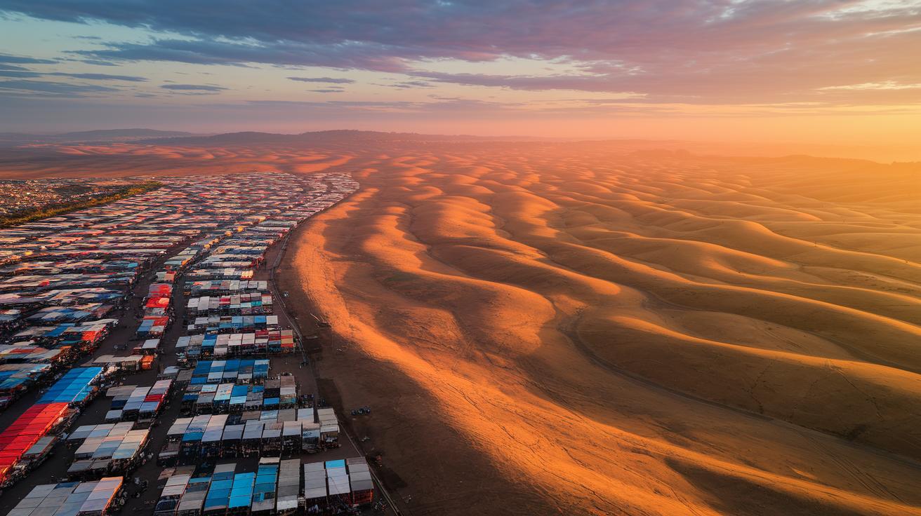
China offers an exciting mix of landscapes, too. Its territory stretches from the sandy Gobi and Taklamakan deserts to the high Tibetan Plateau, while the fertile river valleys of the Yangtze and Yellow Rivers have supported vibrant civilizations for centuries.
The United States is just as diverse. Imagine the endless Great Plains, the warm, sunlit Mojave Desert, and the storied Appalachian Mountains, each area sharing its own unique natural story. And don’t forget Brazil and Australia: one lets you dive into the lively, diverse world of the Amazon rainforest, while the other invites you to experience the raw, arid beauty of the Outback.
Economic and Geopolitical Impact of Large Countries
Imagine exploring a place so vast that its size becomes a powerful force in both money and politics. Russia, with its enormous 17 million km², is like a hidden treasure chest filled with valuable minerals, oil, and natural gas. Picture yourself strolling through a remote Russian area, where every step feels like you’re uncovering nature’s secret gifts that boost the country's standing in the world.
Canada stretches almost 10 million km² and is like a wonderland of endless forests, sparkling lakes, and rich mining spots. Each pristine lake and deep forest seems to fuel its strong trade links that go far beyond its borders. And then there’s the United States, an exciting mix of rolling fields, busy factories, and energy hubs. It’s as if nature and industry share a spectacular dance, creating a vibrant economic scene.
China uses its 9.7 million km² of fertile farmland to shine as a top agricultural producer, while Brazil’s 8.5 million km² Amazon basin acts like a giant natural air conditioner for the planet, keeping climate and biodiversity in balance. These vast lands are more than just pretty landscapes; they power strong economies and shape the world with their strategic influence.
Population Dynamics in the Largest Countries
Imagine exploring vast lands where each place tells its own people story. In China, nearly 9.7 million km² of land buzz with both busy cities and charming rural scenes. It’s like walking through a mix of lively markets and quiet country roads that feel welcoming and warm.
Then there’s India, stretching over 3.29 million km². Picture yourself wandering through the energetic Gangetic Plains, where streets are always full of life and neighbors share a close bond in a fertile, vibrant landscape.
Meanwhile, Russia covers 11 time zones yet feels surprisingly quiet. Its sweeping open spaces resemble peaceful wilderness dotted with small clusters of towns, creating a gentle balance between nature’s solitude and people’s touch.
Over in Canada, most of the nearly 10 million km² is clustered along the U.S. border. Here, bustling urban hubs nestle next to wild, untouched nature, a perfect blend of modern energy and scenic beauty.
In the United States, the busy coastal megaregions are alive with urban charm, but Alaska, which makes up about 17% of the nation, remains delightfully sparse and peaceful. And then there’s Indonesia, a vast collection of over 17,000 islands, where Java stands out as one of the most crowded yet fascinatingly vibrant places on Earth.
Mapping and Visualizing the Largest Countries
Maps really grab our attention, especially when we look at huge countries. They turn numbers into lively pictures that show the curves of deserts, forests, and mountains. Think about it like laying clear country outlines over a world puzzle, suddenly, you see just how enormous these places are. These clever maps make it easy to feel the true size of vast lands.
Using tools like GIS platforms, interactive globe viewers, and even simple print infographics brings each region into view. You can zoom in to check out every little detail, from Canada’s icy northern expanses to Algeria’s warm, sunlit deserts. Often, the best visual guides mix rankings with small map insets so you can see numbers and real-world geography side by side. It turns dry data into a fun and engaging travel tale about our planet’s biggest countries.
Final Words
In the action, we journeyed through the rankings and distinctive features of the largest countries in the world. We uncovered how vast land areas shape diverse landscapes, vibrant economies, and unique population dynamics while offering stunning visuals through maps and comparisons.
The guide not only highlighted impressive statistics but also painted a vivid picture of each country's character through engaging details. It’s a warm reminder that understanding space means embracing the beauty of our shared world. Enjoy planning your next immersive travel experience!
FAQ
What are the largest countries in the world by population?
The largest countries by population are known for their huge communities and global influence. China and India lead these rankings, each housing over a billion people that drive diverse economic and cultural landscapes.
What are the top 10 biggest countries in the world?
The top 10 biggest countries by land area include Russia, Canada, China, the United States, Brazil, Australia, India, Argentina, Kazakhstan, and Algeria. These nations boast vast territories and varied natural features.
What is the smallest country in the world?
The smallest country in the world, Vatican City, spans just over 0.44 km². Despite its tiny size, it holds immense cultural, historical, and religious significance.
Which country is the 7th largest in the world?
The 7th largest country by land area is often identified as India, known for its diverse landscapes ranging from fertile plains to vast highlands across its 3.29 million km² territory.
Which country is the 2nd largest in the world?
The 2nd largest country by area is Canada, covering roughly 9.98 million km². This vast nation is celebrated for its sprawling wilderness, numerous lakes, and varied natural beauty.
Which country is the third largest in the world?
The third largest country by land area is China, spanning nearly 9.71 million km². Its expansive territory features diverse landscapes including deserts, plateaus, and fertile river basins.
Which is bigger, China or Canada?
When comparing land areas, Canada is larger than China. Although China covers nearly 9.71 million km², Canada spans approximately 9.98 million km², making it the bigger country geographically.
Is the USA the 3rd or 4th largest country?
The United States is generally ranked as the 4th largest country by land area, following Russia, Canada, and China, with expansive regions that include varied climates and geographies.
Is China or America bigger?
China is bigger than the United States in terms of total land area. China covers nearly 9.71 million km², while the United States occupies around 9.37 million km², marking a noticeable difference.
What are the 15 largest countries in the world?
The 15 largest countries extend beyond the top ten, including nations with enormous territorial spans. These extended rankings add several countries recognized for significant land area and diverse natural regions.